


|
|
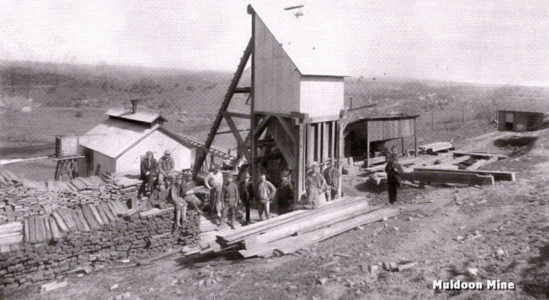
Muldoon Mine, Jackson, Amador County | ||
|
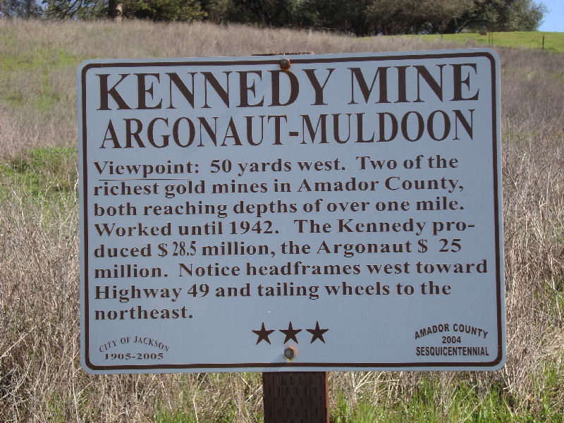
Marker is on North Main Street (Jackson Gate Road), on the left when traveling north. Amador Dispatch - Sept 3, 1909
The Stasal residence on Church street has been leased to Mr. Carr and family. Mr. Carr is in charge of the operations at the Muldoon mine, now called the South Extension of the Kennedy. |
|
|
The Muldoon Mine overlooking Jackson. This mine was eventually taken over by the Kennedy Extension and was utilized as the vent shaft. |
Amador Dispatch - April 1, 1910
The Kennedy Extension commonly known as the Muldoon mine located south of the Kennedy is said to look very promising for the developing into a dividend paying mine. Though only down 800 feet, a ledge has been discovered which is reported to be of paying grade. It has been cut in five places, and work at cross cutting is still being pursued. The mine was opened about a year ago and steadily developed since. |
|
Information, photographs courtesy of the Amador County Archives, The Historical Marker Database |
||
|
|
||