


|
|
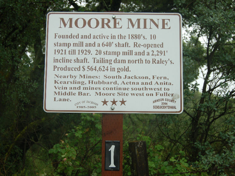
Moore Mine, Jackson, Amador County | ||
|
Marker is at the intersection of Fuller Lane and California Highway 49, on the left when traveling west on Fuller Lane. Located one and one half mile south of Jackson. This mine was active in 1880's. During the time it had been opened to a depth of 640 feet. Ore was milled in a 10 stamp mill. |
|
|
|
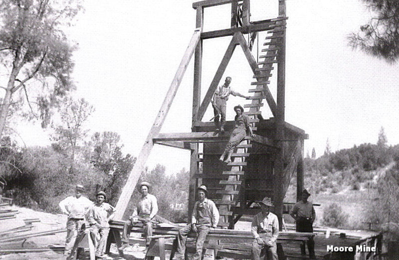
Pictured here from right to left are H.G. Perry, J.L. Irland, G.V. Schacht, J.W. Love, and C. MacKenney. E.R. Santifero standing on the headframe, and G.F. Pickering is sitting on the ladder. Albert "Powder Face" Moore opened the Moore Mine around 1856. His nickname came from a disfigurement of his face that occurred when explosives he was working with went off prematurely. The mine was operated on and off since. It was idle until 1921 when it was reopened by the Moore Mining Company, who operated the mine until 1929. Production amounted to about $ 564,624. |
|
Information, photographs courtesy of the Amador County Archives, The Historical Marker Database | ||
|
|
||